
New Iberia ZIP Coverage
Official New Iberia material uses three five-digit labels: 70560, 70562, and 70563. Those examples prove that each belongs in the city’s practical postal set, but they do not supply parcel-level boundaries. The ZIP code directory therefore treats them as delivery clues. An exact street address still needs a USPS check, and the incorporated city line needs a city or parish map.
| ZIP | Documented New Iberia use | Postal reference | Search note |
|---|---|---|---|
| 70560 | City and parish offices, property records, general city mailing identity | New Iberia Post Office, 817 E. Dale Street | Common label, not proof of city limits |
| 70562 | Courthouse, cemetery, and institutional mailing examples | No station assignment confirmed | Possible special mailing pattern; exact type unconfirmed |
| 70563 | Residential property, cemetery, park, and library examples | No station assignment confirmed | Verify each full address |
Do not label 70562 as a PO-box-only ZIP. The research found official mailing and institutional examples but no stable USPS classification page that settles its type. Likewise, a 70560 address can lie beyond the incorporated city, and a single road can change postal routing by block or service boundary. Precision starts with the full address, not a colored ZIP map.
Verify a New Iberia ZIP
The USPS ZIP Code Lookup is the final authority for present delivery formatting. Its address path asks for street, city, and state. A second route lists ZIPs associated with a city and state. Enter apartment, lot, unit, and directional details exactly when they form part of the address. Save the returned format and search date.
A historical directory may predate five-digit codes or use an older postal zone. In that case, retain the wording printed in the source, then place the modern USPS result in a separate field. No official New Iberia ZIP realignment notice or historical split table was located. A question about an older route should go to USPS or the local post office, not be resolved by guessing from today’s code.
Can a postal code prove New Iberia residence? No. It establishes mail routing for an address. Ownership, occupancy, voter status, tax ward, and municipal jurisdiction require their own records.
New Iberia ZIP Voter Fields
Louisiana’s voter portal offers the clearest official ZIP-aware forms. The name screen combines first and last names with ZIP and birth month/year. The address screen combines ZIP, street address, apartment or lot, and a city dropdown. The parish route begins with a parish selection. Each result is a current registration lookup with protected data withheld.
| Portal path | Fields | What the result means |
|---|---|---|
| By voter | First, last, ZIP, birth month/year | Current registration match |
| By address | ZIP, address, apartment/lot, city | Address-form return, subject to disclaimer |
| By parish | Parish dropdown | Parish search route |
| Paid voter list | Order criteria and output format | Statutory public fields with omissions |
The voter lookup by address and ZIP shows the fields that should be recorded with any result.
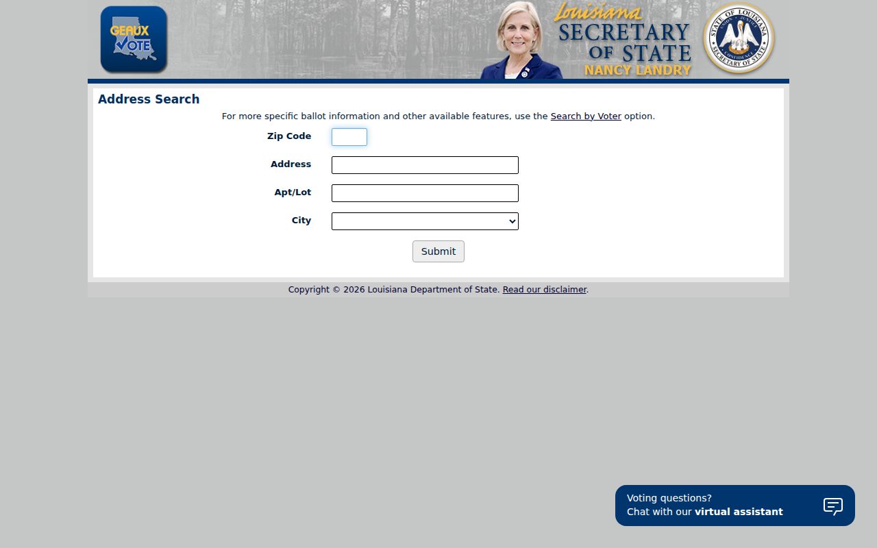
Apartment and city inputs matter on shared streets. A ZIP alone is too broad to identify a person.
The portal also provides a parish-based voter route when Iberia Parish, rather than one postal area, is the correct geography.
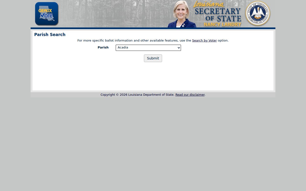
This second route shows why parish and ZIP searches should remain distinct even when both lead into the same official portal.
New Iberia ZIP Privacy Limits
The portal disclaimer says voter records are not linked to address records and address records are not linked to voter records. That warning blocks a common mistake: treating an address-form result as proof that every listed name occupies one parcel. Recent moves, spelling, registration updates, and statutory protection can all affect the screen.
The Louisiana voter portal disclaimer also warns users not to enter a Social Security number, email, full date of birth, or mother’s maiden name.
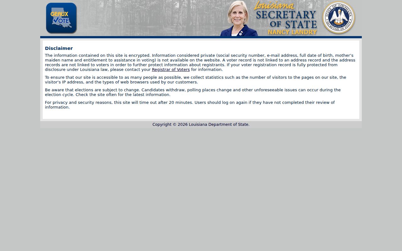
The privacy notice is part of the result’s meaning, not a footnote to ignore. Protected records must not be inferred from an absence.
Search New Iberia Residents by ZIP
A ZIP code directory narrows the area before a name or address search. It does not create a list of every resident. Use the code with a second field in the voter portal, or use it to confirm the mailing portion of a known parcel card. The Assessor has no visible ZIP filter, so do not invent one.
- Verify the full address through USPS and save the standardized postal result.
- Search the Iberia Parish Assessor by street, owner, or parcel, then read the ZIP from the detail card.
- Use the voter name or address form with ZIP only when registration status is relevant.
- Compare city limits, ward, parcel geometry, and ZIP as separate fields before drawing a geographic conclusion.
The city tax portal searches notice or bill number, parcel, taxpayer name, address, and tax year. A distinct ZIP field was not confirmed. Its New Iberia property tax search can help after a parcel or address is known.
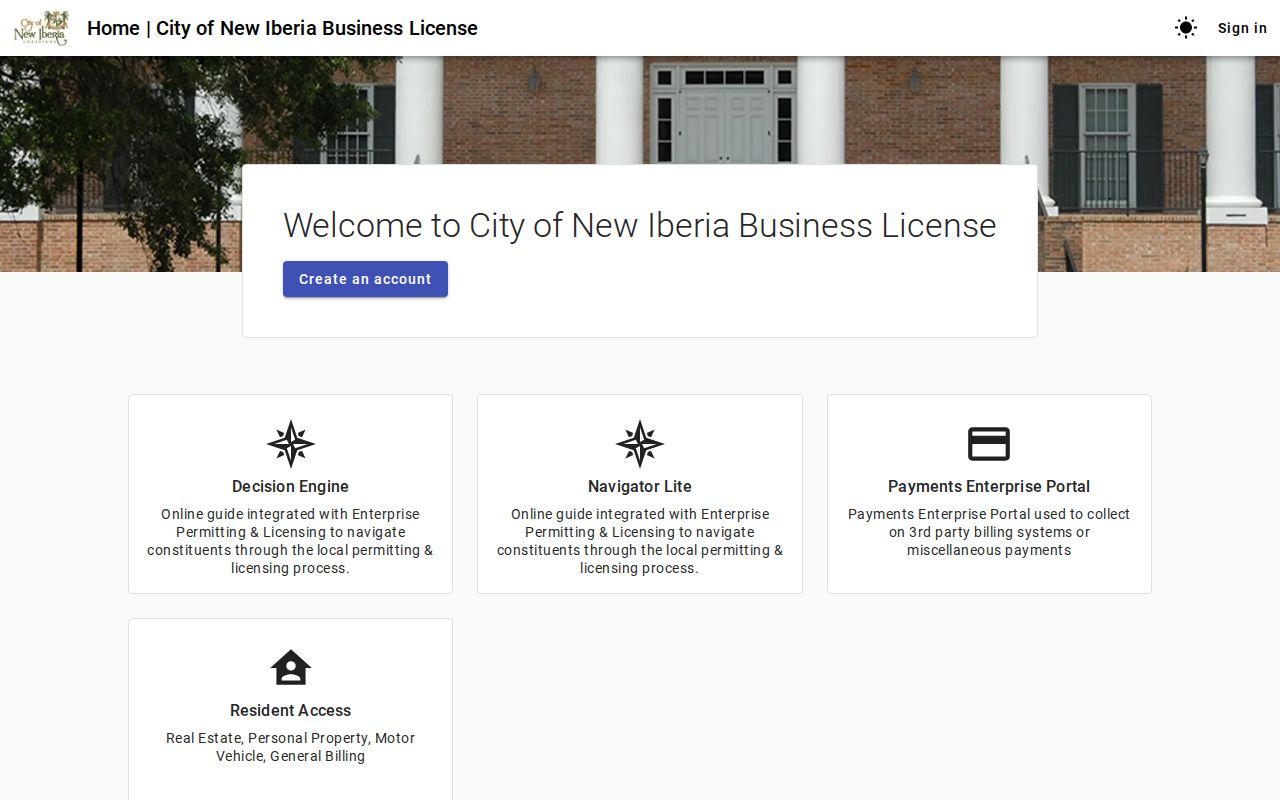
The visible tax search paths reinforce the right sequence: use ZIP for postal routing, then use parcel or street keys for the property record. For block-by-block work, continue with the New Iberia street directory.
New Iberia Assessor ZIP Gap
The Iberia Parish Assessor search accepts tax year, parcel number, owner name, property address, section-township-range, subdivision, and legal description. It does not expose a ZIP field in the inspected interface. Search the street number and name, open the parcel detail, then copy the physical and mailing addresses without combining them.
A sample 70563 parcel shows why the distinction matters. The parcel card can hold an assessed owner, a mailing address, a different physical address, ward, legal description, and deed or ownership history. The ZIP attached to a mailing address may describe where a notice goes, while the physical parcel occupies a separate mapped place.
The public GeoSync map can identify parcel geometry and adjacent tracts. Its accessible interface did not publish a verified ZIP layer or parcel crosswalk. Use map geometry for parcels and USPS for delivery codes. The assessor also warns that the map is not an official document.
Three New Iberia ZIP Tests
Each local label calls for a different check. A residential card showing 70563 should be tested through USPS with the complete street address. Preserve both values if the postal result and older assessor field disagree. A courthouse, cemetery, or institution using 70562 does not assign that code to nearby homes. Determine whether the record describes a drawer, institution, route, or street delivery.
For 70560, a City Hall or parish-office address demonstrates a valid New Iberia postal label, but the same label can extend beyond the incorporated line. City or parish GIS and the responsible custodian establish municipal limits. ZIP does not.
- Record the source, date, full address, and exact five or nine-digit value.
- Label the field as mailing, physical, voter-entered, USPS, or historical.
- Keep an alternate value when two reliable dated sources disagree.
- Ask the source custodian about a routing or boundary gap.
This method turns a discrepancy into a documented research lead. It avoids silently “correcting” an old record with a modern label.
New Iberia ZIP Versus ZCTA
Census ZIP Code Tabulation Areas, or ZCTAs, are generalized statistical shapes. They are designed to report population data, not to reproduce current USPS carrier routes. New Iberia’s 2020 Census population was 28,555 across 11.14 square miles, while the July 1, 2025 city estimate was 26,533. Those dated city figures should not be assigned to a postal code without a matching Census product.
Likewise, New Iberia’s Bayou Teche corridor, downtown, West End, Hopkins Street, parks, and rural-edge addresses do not become formal neighborhoods because they share a ZIP. Ward, council district, parish boundary, and postal route remain separate. This geography rule is especially useful near outer roads where a New Iberia mailing label may extend beyond the municipality.
Geography check. State whether a total uses city limits, a Census ZCTA, a USPS result, a tax ward, or parcel geometry.
New Iberia ZIP Boundary Limits
No official machine-readable ZIP-to-parcel crosswalk or New Iberia boundary overlay was located. That gap matters. A single street may change ZIP by block, side, apartment routing, institution, or delivery route. Deeds, voter files, assessor cards, and old directories can also preserve different address forms. A ZIP lookup proves delivery routing only.
This New Iberia ZIP code directory therefore avoids unsupported neighborhood claims and historical split dates. For a present address, use USPS. For city limits, use city or parish GIS. For ownership, use the Assessor and recorded deeds. For voter status, use the state portal and heed its non-linkage warning.
- ZIP
- A five-digit USPS code used to sort and deliver mail.
- ZIP+4
- A nine-digit form that narrows delivery to a smaller segment, unit group, or box range.
- PO-box ZIP
- A code or delivery pattern serving post-office boxes. That status was not confirmed for 70562.
- Unique ZIP
- A code assigned to one high-volume organization. No unique New Iberia code was confirmed.
- Carrier route
- A postal delivery path that can cross other government or neighborhood boundaries.
Note: Keep a source’s exact ZIP, its date, and its address type so later researchers can see why two records differ.